Day 12

Wednesday, 5 July 2006
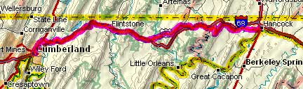
  Cumberland, MD to Hancock, MD
40.8 miles, 4h27m, 9.2 mph
Elapsed Time: 5h21m, Max speed: 40.0mph
Total Climbing: 4015ft, Max elevation: 1639ft
Total mileage: 863.0


Copyright 2002 DeLorme. Topo USA. Data copyright of content owner.


A short day today, but a hard one.  I had two choices for getting from Cumberland to Hancock: the flat, muddy C&O Canal or the hilly, paved route down US40 and MD144.  I chose the latter.  The guys from PA I'd been talking to chose the former.   I got rained on but came in dry.  They got rained on but came in muddy.  I think I made the right choice.

It was raining when I woke up so I ate breakfast and puttered around until about 8:15.  By then it had stopped raining, but it looked like more showers were on the way.

It turns out there are five major climbs between Cumberland and Hancock, and they started right away.  The rain started soon after that.  The first climb was Martin Mountain.  The road was good, the grade was steep, but not too steep.  The climb was about 5 miles long.  Then there was a 5 mile descent through Flintstone and right up to the next climb.


Nearing the top of Martin Mountain.

The second climb was Polish Mountain.  It was steeper than Martin, but not as long, so it didn't seem so bad.

Then came Green Ridge, which I thought was a big hill, but it turned out it wasn't that big compared to the next one.  It was really steep because it was on "Scenic US40."


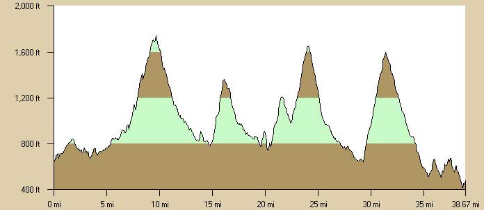
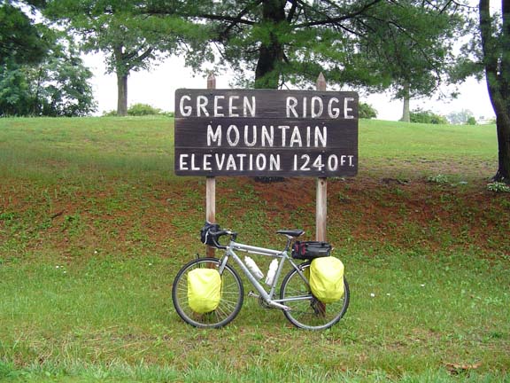
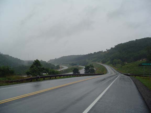
I thought this was a big hill, so I took a picture.

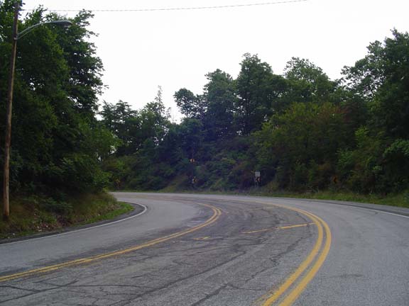
The climbs were very slow so I'd take off my jacket, the descents were very fast and cold, so I'd put it back on at the top.  As I suited up on top of Green Ridge a guy in a pickup stopped and asked me if I wanted a ride.  I thought, "Why would I want a ride?  I'm on top of the hill."  So I declined, and descended.

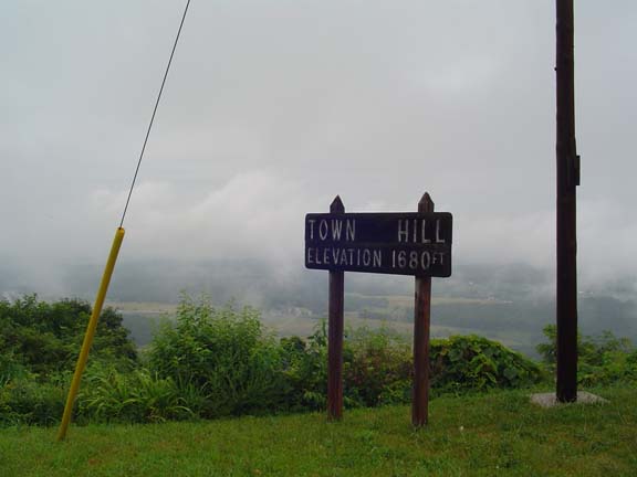
Town Hill started right away.  It was really long and really steep.  Uggh.

There are two payoffs for climbing these hills: the view and the descent.  The views were cloud-obscured and the descents were too scary to enjoy.  I usually don't use my brakes on descents unless I have to, but I kind of like to have the option to use them.  With the wet rims and wet roads and the weight of a loaded touring bike, my stopping distance could be measured in furlongs, so I had to be a little more cautious about letting the bike run.  Still, it was more fun than climbing.


The cloud-obscured view from Town Hill.

Sideling Hill was the climb I was really worried about.  I stopped at a gas station for lunch and refilled my water bottled for the big climb.  It turns out it wasn't so bad.  The first part was steep, but the rest wasn't bad at all.  Of course there was no traffic.


The top of Sideling Hill.  There's no view.

The descent was about 5 miles long and very relaxing.  By this time it had stopped raining and my gear was drying out.  There were a few small hills on the road into Hancock.  I was in the motel by 1:30.  Time to eat.


The run into Hancock: typical scenery.

Tomorrow I ride to Frederick.  There should be only one big climb over South Mountain.  Hopefully it will be sunny.


Previous | Next

"Erie Canal (and more!) Tour 2006" Copyright © 2006 By Bob Clemons. All rights reserved.