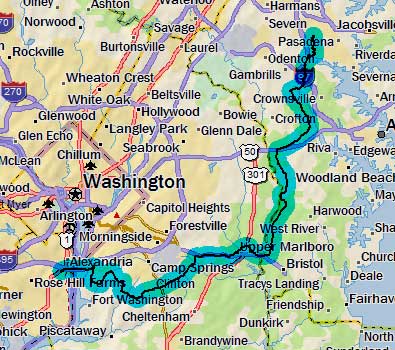
Day 1
Saturday,
10 October 2009
Millersville, MD to Alexandria, VA
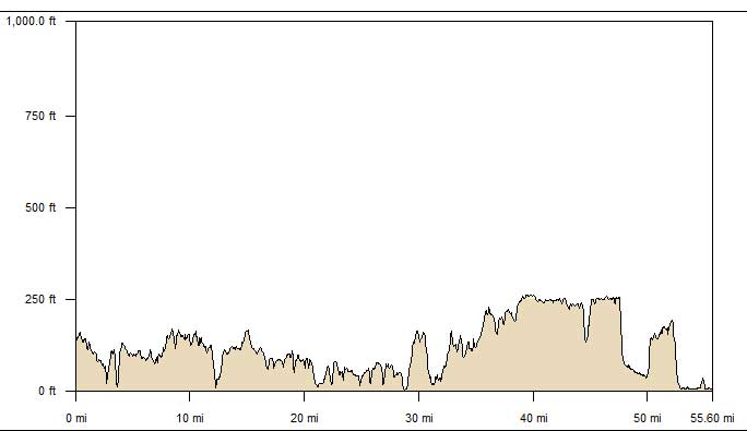
56.4 miles, 4h54m, 11.5 mph
Elapsed Time: 5h50m, Max speed: 36.0mph
Total Climbing: 2870ft, Max elevation: 273ft
Total mileage: 56.4

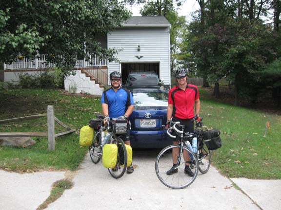
We aimed to start late Saturday morning because both of us were
scrambling right up to the last minute getting ready. Amazingly we
rolled out right at 10am like we planned. It was a cloudy and windy,
with light rain from time to time.
The beginning of our attempt to become the first riders to claim to be
the first riders to
circumnavigate the District of Columbia.
But this ride was not a mere quest for glory. I also planned to use the
ride to try out some new gear. Mainly I wanted to try out my new
camera, which is somewhat smaller than my old one. I wanted to try
whipping the new camera out while moving to see whether I could take a
photo without dropping the camera or pushing the wrong buttons. On my
first attempt I fumbled the camera, juggled it a bit, and then caught
it. In my fumbling, however, I somehow ripped off the binder clip that
I use as a map holder. After restoring the binder clip I noticed that I
had shattered my bike computer. I must have spiked the camera into it.
This was not the tragedy it appears. The ol' Vetta 100A has been balky
for a while, and never recorded a single turn of the wheel on this
trip. It's days were numbered anyway, and the camera simply
administered the coup de grace.
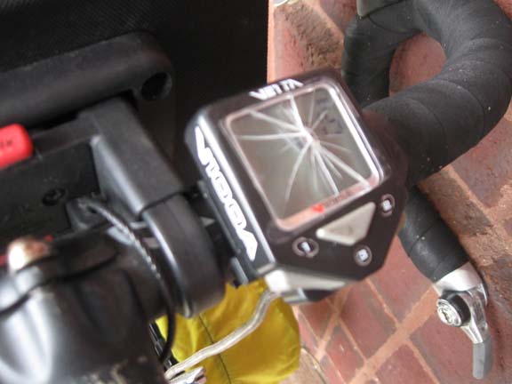
My shattered Vetta 100A was useless long before this happened.
We picked our way south on the familiar
roads of Anne Arundel County. Eventually we crossed the Patuxent
River and climbed a long and unpleasant hill into Upper Marlboro. We
could tell we were near the county courthouse when we came to an
intersection where the businesses on all four corners were purveyors of
fine bail bonds. We ate lunch at a nearby Subway. When we came out it
was raining the hardest it rained all day, which was just barely hard
enough to put on rain gear.
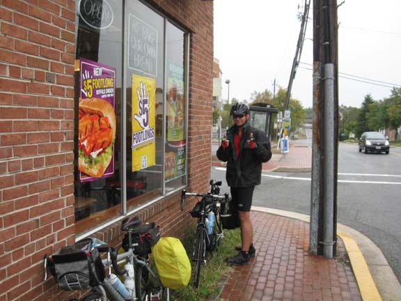
Post-lunch donning of rain gear in Upper Marlboro
I kept my rain gear on for about 3 miles, Balint for longer. Then there
were miles of riding through suburban Prince Georges County. A brief
stop in Clinton. Woodyard Road was signed as a bike route, but it
didn't look like the SHA put any real effort to make the road appealing
to cyclists--other than putting up the signs, that is.
Eventually we reached the Henson Creek Trail and turned on to the bike
path through the scrubby woods near the creek.
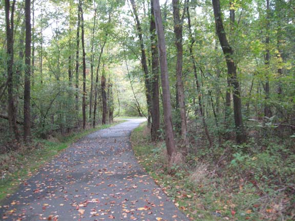
A busy Saturday on the Henson Creek Trail.
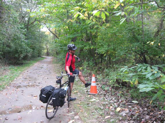
Balint shows his disrespect for traffic control devices by picking on
this lonely cone.
At the end of the trail we turned north on Oxon Hill Road to reach the
National Harbor complex. The Harbor includes a brand new bike path that
took us to the Wilson Bridge bike path.
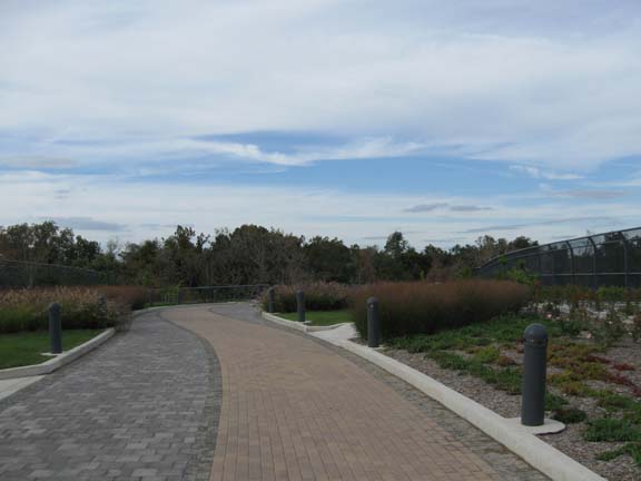
This peaceful scene is actually on an I-95 overpass at the east end of
the Wilson Bridge.
I fumbled my camera for the third time while on the I-95 overpass. This
time I dropped it. I watched helplessly as it bounced along the bricks
within inches of my spinning wheels. For some reason it stayed
alongside and did not dive under my back wheel as one would expect. The
camera was unhurt.
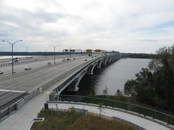
The new Wilson Bridge bike path.
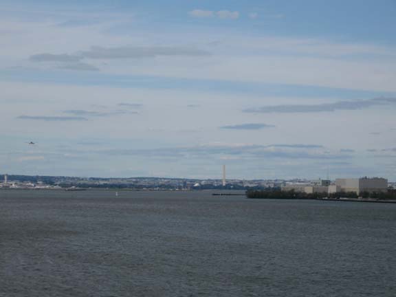
Looking north toward DC.
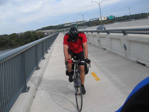
Balint, checking out his knees.
At some point on the bridge we passed directly over a piece of river
bottom that belongs to DC. This is not the closest we would get to DC
on this trip. That will come tomorrow.
Once we crossed the bridge it was less than a mile to the Hampton Inn
by bike path. We took a hotel shuttle into old town Alexandria for a
fine Italian dinner. It was a bit cool, so we were almost the only
idiots walking around in shorts.
Next
"'Round DC 2009" Copyright © 2009 By
Bob
Clemons. All rights reserved.