Day 2
Saturday, 6 Jun 2015
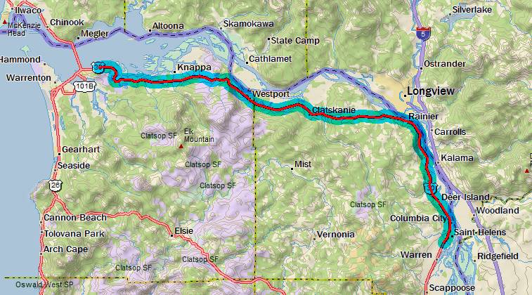
Astoria, OR to St. Helens, OR
66.3 miles, 5h13m, 12.7 mph
Elapsed Time: 6h26m, Max speed: 43.9mph
Total Climbing: 3002ft, Max elevation: 779ft
Total mileage: 79.5

I expected day 2 to be the least pleasant of them all--and it did
not disappoint. Lots of high-speed traffic, big climbs on roads
with small shoulders, even a flat tire.
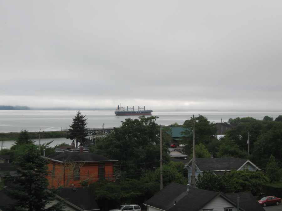
Still, it was way better than a day in the box. Even if it started
off a bit cloudy and cool.
John Day, Oregon. The residential district.
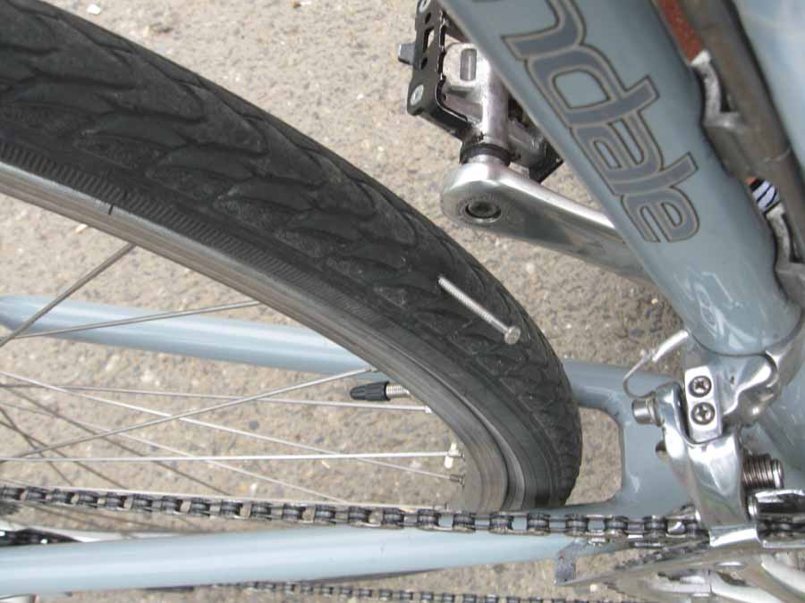
I was coasting down a nice hill when all hell broke loose under
me. I stopped as quickly as I could and found this nail in my
tire.
I think it's a finishing nail--and it sure finished that tube. I'm
glad I didn't buy new tires this year.
This could have done a lot of damage, but it didn't rip the straps
off my trunk bag or anything like that. So I slapped some duck
tape
inside the tire, changed the tube, and was on my way.
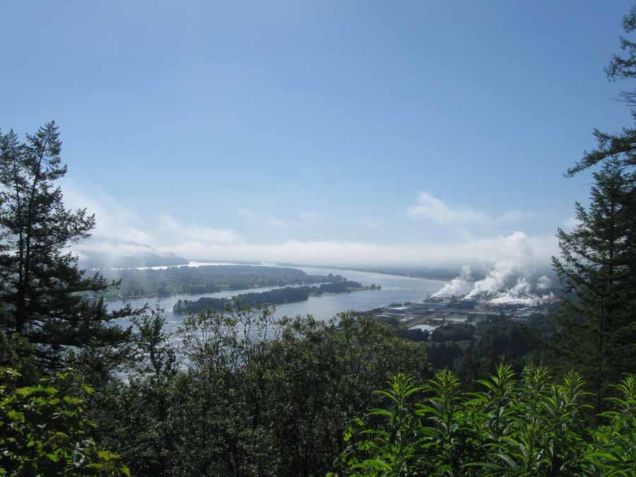
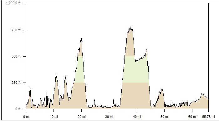
The first big climb was Clatsop Hill, 665ft. It had a nice view up
the river. I was fortunate that in my direction the climbs
are longer but not so steep. I passed a couple guys going the
other way, and they really had their work cut out for them.
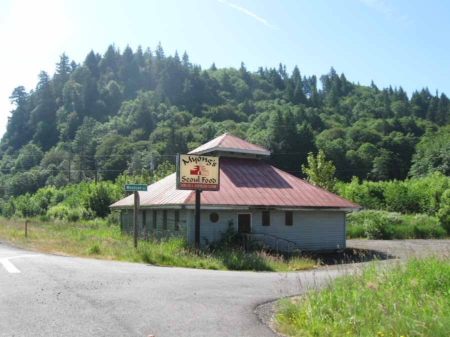
After the first climb there was a 10 mile flat stretch till the
next one. Oddly enough this Korean restaurant couldn't
make it right between Westport and Clatskanie.
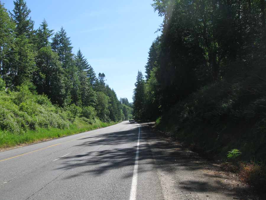
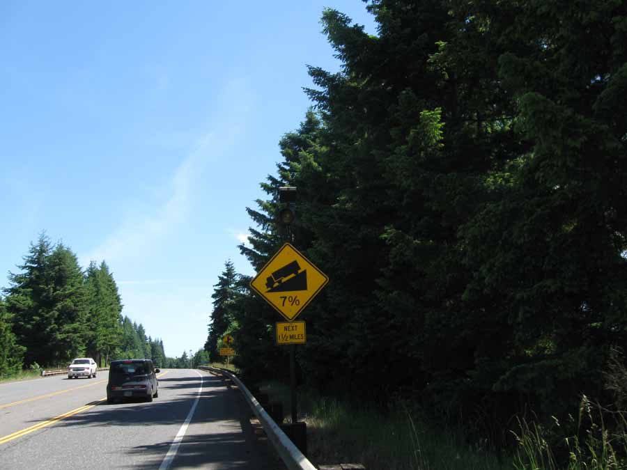
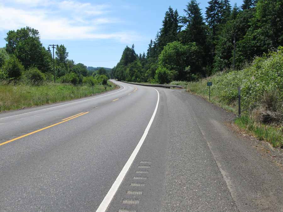
The big climb was Clatskanie Hill, 760ft. Notice how the shoulder
goes away when they add the passing lane, because, you know,
it's not like the cars and trucks go by at 60mph in that lane. By
the way, the Oregon bicycle map says this road has 4 foot
shoulders.
Maybe if you add both sides together.
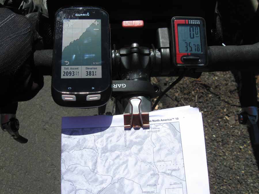
My cockpit. This is the first year that I am using GPS. Note I
have placed it in soul-crush mode during the Clatskanie
climb--just so I would
know that I will never get to the top (The liquid on the GPS is
tears). I use the old-school bike computer to show speed and
distance traveled.
I use the paper maps to catch my sweat.
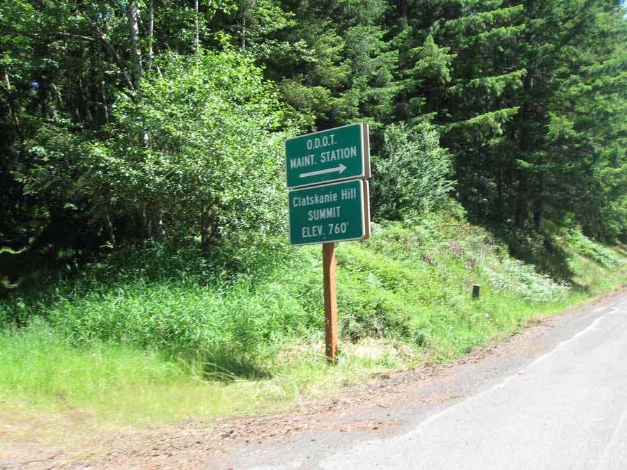
It seemed like a lot more than 760 feet.
And then the payoff.
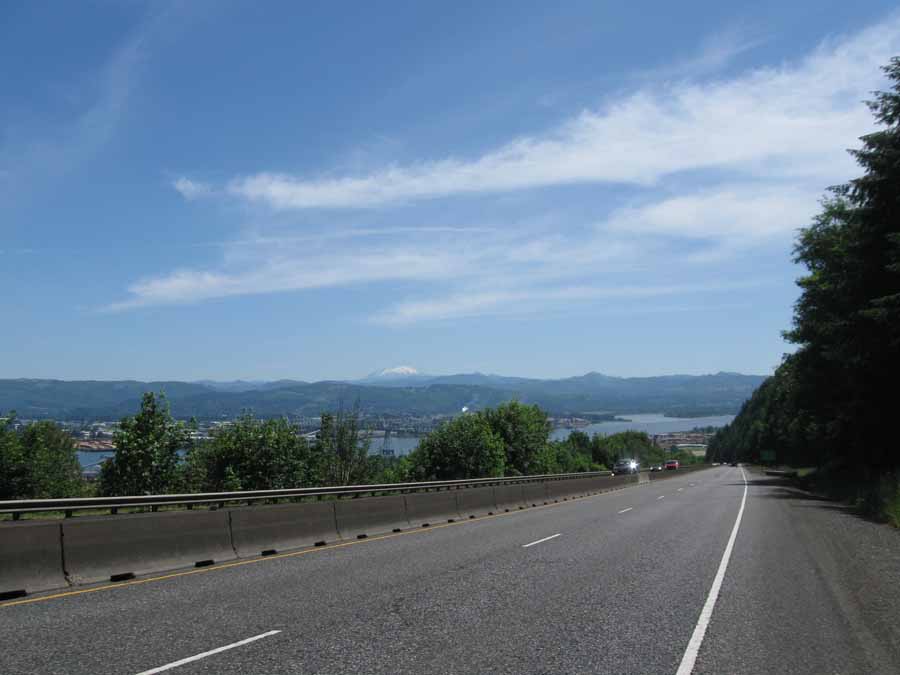
The screaming descent down to Rainier, Oregon. That's Mt. Saint
Helens in the distance. I topped out at 43.9mph on this one.
After that it was a nice run in to St. Helens on roads with
sensible rumble strips. We had lunch at a food truck, then we went
to the
Ye Ol' Grog Distillery to try their Vodkas and Grogs. We left with
a few bottles. We're gonna look for a brewery for dinner.
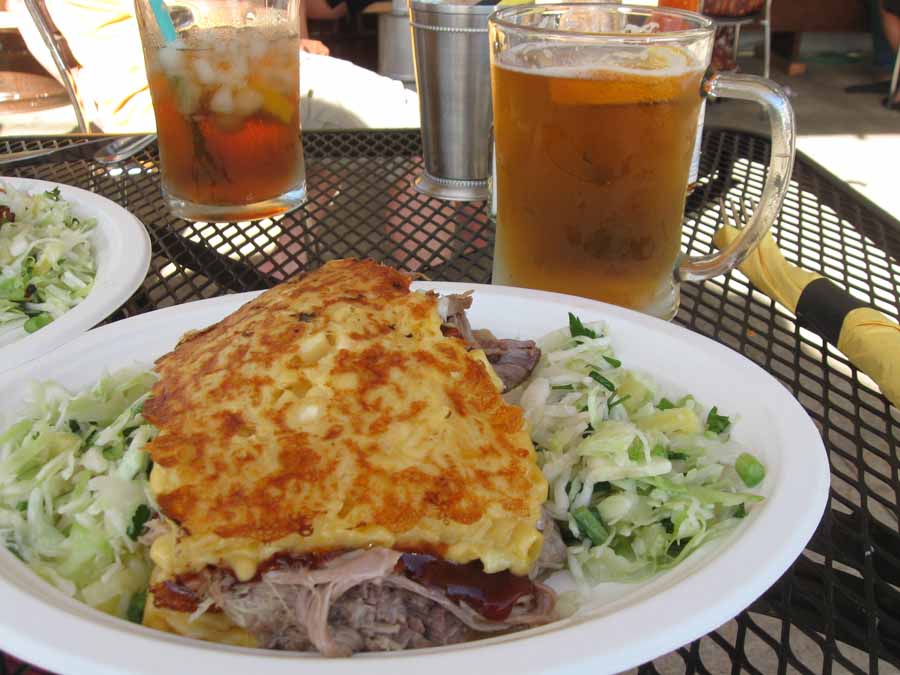
This was dinner at the Columbia County Brewing Co. Smoked pulled
pork between two slabs of baked mac & cheese, with
Hawaiian cole slaw. It's called the Mac Daddy Squealer.
Tomorrow I ride through Portland.
Next
"Northwest Tour 2015" Copyright © 2015 By Bob
Clemons. All rights reserved.