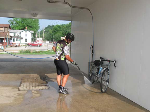
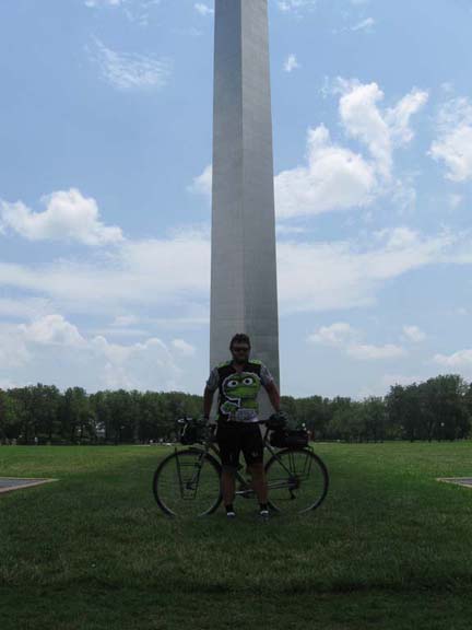
Had to spruce it up, you know, for the post-ride photos.
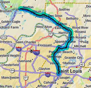
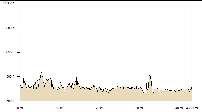
Then there was a 12-mile cruise down the highway back to Alton. The
trail reappeared before town, and it was crap, but I rode it anyway. It
was a little dicey finding my way through Alton, but as long as I kept
the River on my right I was okay.
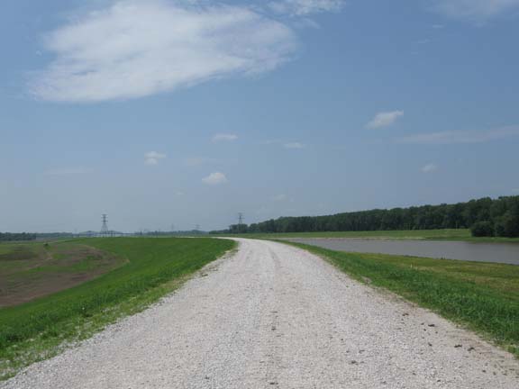
The trail resumed south of Alton. Mostly it cruised along the top of
the levee, which provided some good views.
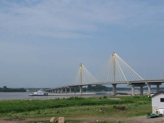
The Clark Superbridge at Alton. And some barges going under.
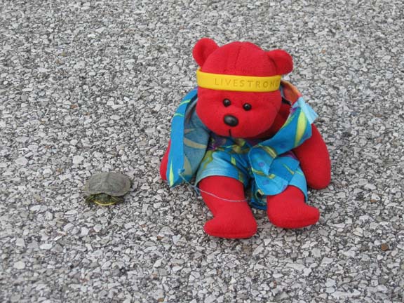
The smallest turtle I'e ever seen in the wild. (Bear for scale).
Soon I approached the Corps of Engineers' National Great Rivers Museum.
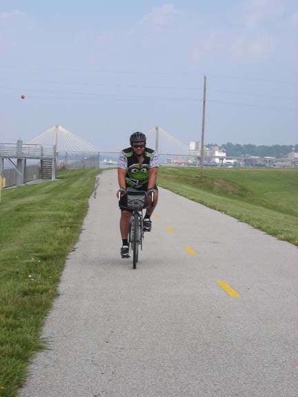
Linda was waiting with a camera to document my odd pedaling style.
Linda and I spent a few minutes in the museum, then it was back to the
path for the ride to the next museum: the Lewis and Clark Interpretive
Center. The museum is on the site where the Lewis & Clark
expedition spent the winter before departing for the west. There was a
film and a reconstructed little fort thing. But we liked the little
game where you try to load up a keel boat with colored blocks so that
it stays balanced and won't sink and you can get to all the stuff you
need to get to. Reminds me of loading a bike up for touring--except a
million times more complicated.
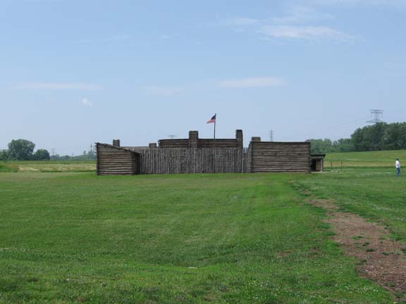
Reconstructed quarters. It was too hot and humid to walk all the way
out there.
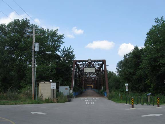
The next feature of the trip was the Chain of Rocks Bridge. This bridge
carried Route 66 until 1967, when it was closed. Since 1998 it has been
a pedestrian/bicycle bridge. Some say it is the longest such bridge in
the world. Seems like that ought to be verifiable.
But before the bridge, the trail went all to hell. The wind, the heat,
the humidity, my bruised hands.
I quickly became cranky.
But the Chain of Rocks Bridge made me happy.
This was my eighth and final crossing of the Mississippi on this trip.
Counting my crossings from my Natchez Trace trip, I've crossed the
Mississippi by bicycle 10 times on ten different bridges.
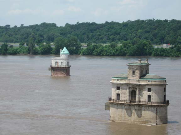
These water intakes for the St. Louis waterworks are just downstream
from the Bridge.
Interesting architectural styles.
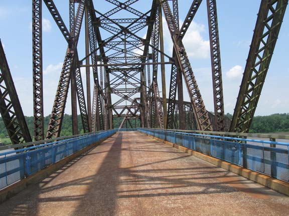
One cool thing about the Chain of Rocks bridge is the bend in the
middle.
You don't see that on many bridges.
On the other side I asked some hard-core-looking cycling dudes if the
trail I was on would take me all the way to St. Louis. They said yeah.
They were fixing a flat and were just getting ready to leave. I hit the
trail while they hit the adjacent road. I stayed ahead of them for a
while in spite of some little climbs. They were just about to catch me
when I heard pone of them puncture again. It sounds like this:
Psss...psss..psss...Sh*t!..pssss...psssssssss.
It was a long 10 miles down the Riverfront Trail through some serious
industrial neighborhoods.
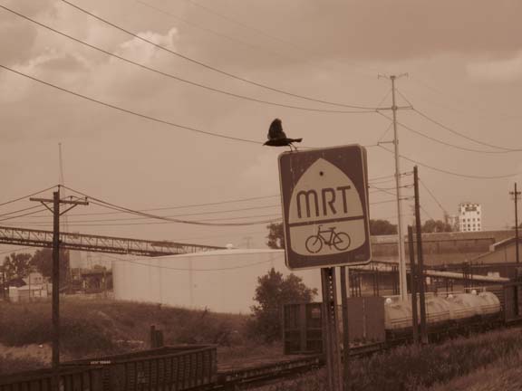
I wasn't trying to be artsy here. I was trying to take a picture of the
blackbird on the MRT sign.
The bird just sat there when I rode by, so I turned around to get the
picture, but sometimes you
only get one chance. The camera was in sepia mode because I can't pick
the thing up
without screwing up something.
Eventually I reached the waterfront at the Gateway Arch. We took a
whole bunch of pictures. But first I had to schlep my bike up the
stairs.
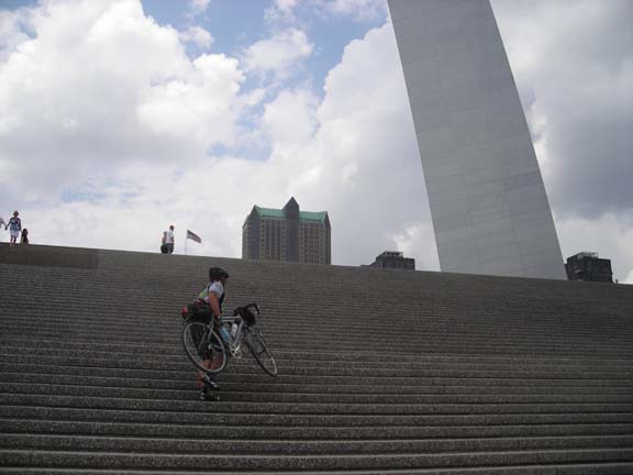
Not as steep as the lawn.

That's the north leg.
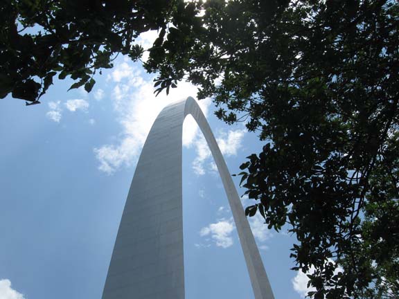
This proves I went under the Arch.
Typical tourist photo.
Then we loaded the bike in the car and drove to a bike shop, where the
bike will be packed and shipped back home. We drove back downtown and
checked in to the Hilton. We took a walk around the neighborhood
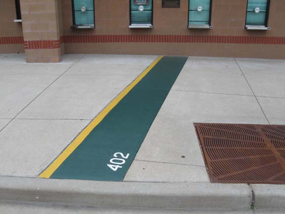
looking for traces of old Busch Stadium. All we could find is the
location of the right field line and the outfield fence on the sidewalk
outside the new stadium. Home plate is not marked, but it appears to be
in left field of a little softball field across the street from the new
ballpark. Maybe tomorrow we'll go looking for Sportsman's Park.
The new ballpark overlaps the old stadium.
We had an excellent dinner at Carmine's,
a block from the hotel. We had to time it just right to get over there
between thundershowers. Good thing I had my cycling rain gear.
Tomorrow we'll do some tourism and fly home in the afternoon.
This has not been my favorite trip ever. Nevertheless, I declare it to
have been an unparalleled success.