Day 4
Tuesday, 1 June 2010
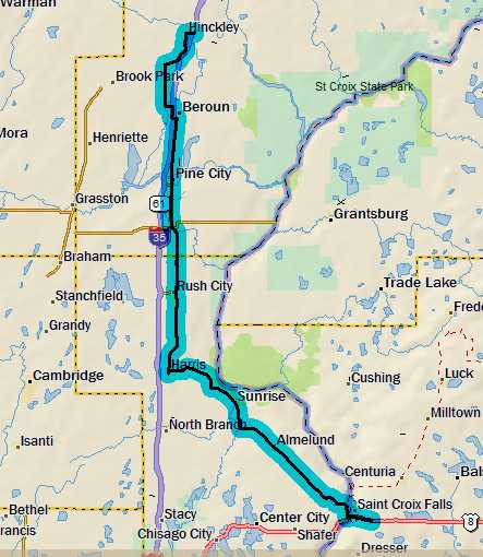
Hinckley, MN to St. Croix Falls, WI
59.4 miles, 4h50m, 12.3 mph
Elapsed Time: 6h00m, Max speed: 29.5mph
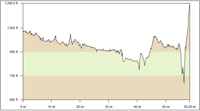
Total Climbing: 1266ft, Max elevation: 1220ft
Total mileage: 298.9

It was supposed to rain, so we broke camp early--after a hearty meal in
the Days Inn breakfast room. We managed to get out the door at 7:10am.
As we continued south, the scenery was the same as yesterday--except it
was much more interesting seeing everything from the road.
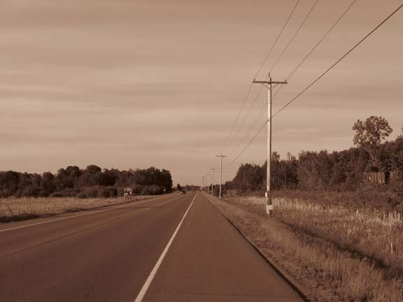
And everything was in black and white.
Our plans were nearly thwarted early when the bridge we needed to use
to cross I-35 was broken. The detour was to get on the interstate,
which didn't seem like a good idea. Fortunately we found an alternate
road--and what an alternate. It was the smoothest pavement ever--like
polished asphalt. And it was in color.
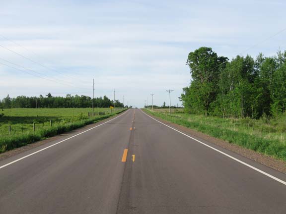
Like polished asphalt.
You'd be amazed at the things that make you happy after a few days on
the road.
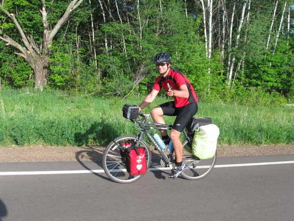
We were so happy, we took in-action photos.
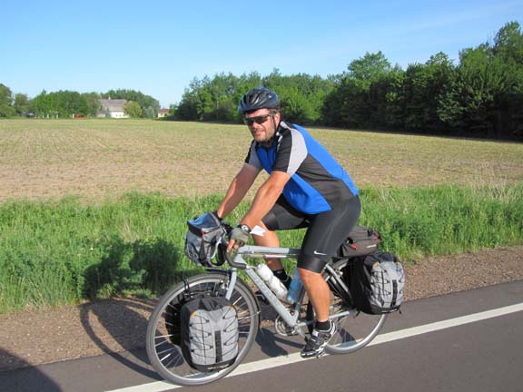
My bags almost match the road.
Eventually we got back on to Old Rte 61--which is pretty much the same
road we've been on the whole trip so far. Not sure why it's "Old 61"
since there is no newer 61 anywhere around. We ran through a few towns
without stopping. We really wanted to beat the rain, and there was an
annoying headwind grinding us down. At some point we decided that we
would push through to St. Croix Falls without lunch to make sure we
beat the rain.
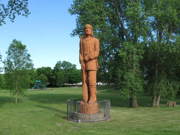
We stopped long enough in Pine City to photograph this wooden Indian.
I'm guessing it's made of pine.
There was more grinding and grinding and
eventually we reached the town of Harris, where we turned off of Ol' 61
for good.
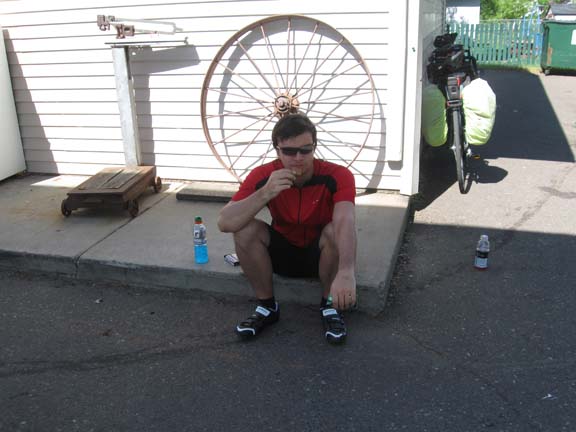
And we rested near a wagon wheel and an old scale.
Our new road, County Route 9 was beat up and had susprisingly heavy
truck traffic. On the up side, we weren't always going straight in to
the wind anymore. At some point we passed through the town of Sunrise,
birthplace of actor Richard Widmark--so the sign said.
After Route 9 came State Route 95, which was much larger and had a
shoulder. But the shoulder had a nearly invisible two-foot-wide rumble
strip right in the middle. So we had to ride either right on the edge
of traffic or way over on the edge with the debris. We never did figure
out which was better.
We were pretty beat when we reached the store at Almelund. So beat that
we each ate a small pizza (this didn't count as lunch). The woman in
the store told us it was only about 10 miles to Taylor's Falls, and one
more to St. Croix Falls. And she said it was mostly downhill. So we
were encouraged.
And she was right. The final descent into Taylor's Falls was swell, and
included a stop at a scenic overlook.
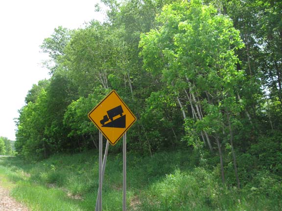
Been a long time since I've seen one of these. The ol' truck-on-a-wedge.
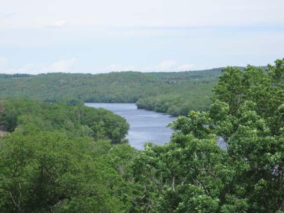
The St. Croix River. By the way, there are no falls in St. Croix Falls.
Used to be, but they're underwater now.
Then we had to make the ridiculous climb out of the valley to the
motel. Turns out the Wisconsin side it a lot higher than the Minnesota
side.
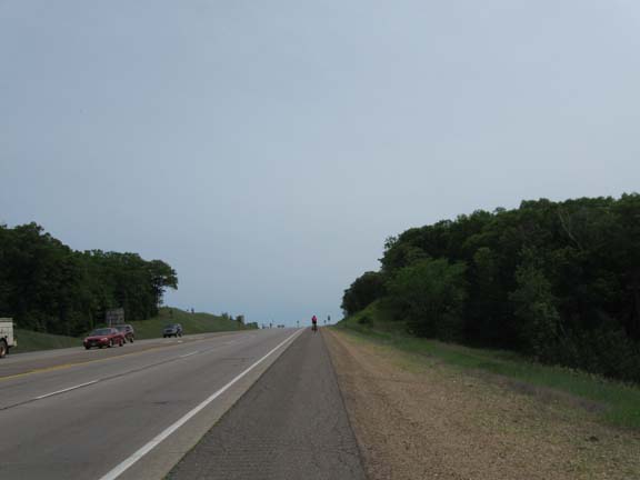
Balint on the final climb. Note the stupid rumble strips.
We went to lunch at about 2pm. We had
omelets and pie. The pie was better than the best pie on the planet we
had yesterday, so this must be another planet. Then Mr. Balint went out
for some drinks, and he ended up with a haircut. It rained at about 4pm.
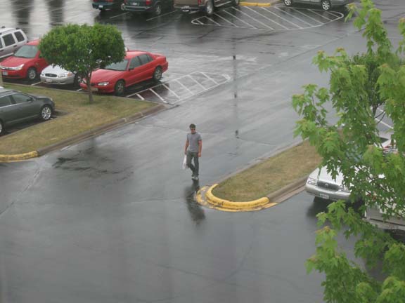
Mr. Balint returns. Wet, but shorn.
The plan for tomorrow is to ride in to St. Paul. It's a fairly short
ride, but we'd like to spend some time in town and visit the Science
Museum of Minnesota and see the Dead Sea Scrolls. Also, we'd just like
a short day.
Next
"Upper Miss Tour 2010" Copyright © 2010 By
Bob
Clemons. All rights reserved.