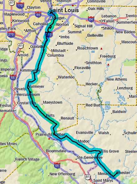
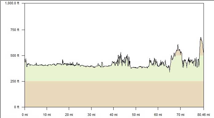
Day 1
Friday, 27 May 2011
St. Louis, MO to Chester, IL
81.1 miles, 6h35m, 12.3 mph
Elapsed Time: 8h31m, Max speed: 35.7mph
Total Climbing: 4240ft, Max elevation: 675ft
Total mileage: 81.1

Day One was supposed to be about 70 miles. Through bungling I managed
to extend it to 80.
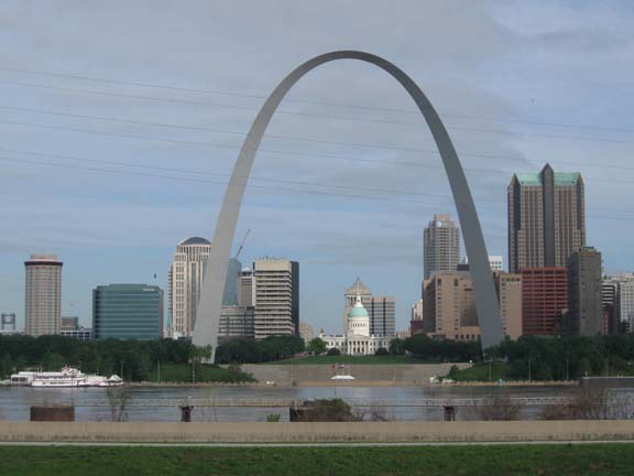
After stuffing myself with breakfast at the hotel buffet, I waddled out
the front of the hotel and on to my bike. It did not collapse. I
cruised down to the Gateway Arch where Linda was waiting to take the
official start photo.
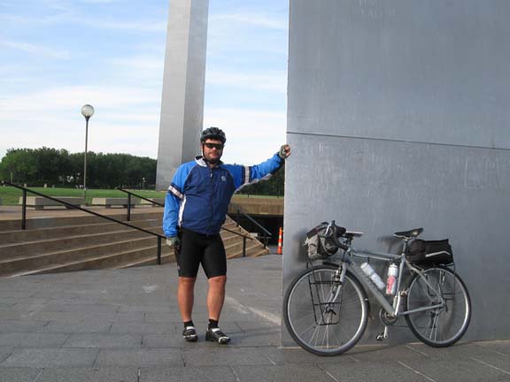
And so I cross paths with last year's ride.
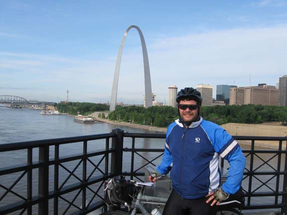
Next, I rode over to the Eads Bridge for
my eleventh crossing of the Mississippi River by bicycle. About halfway
across I met a couple of German guys who were touring America and
living out of the giant backpacks they were carrying. I took their
pictures using their film cameras and they took mine using my digital
camera.
I smiled so the Germans wouldn't think I was less friendly than a
German.
Across the Eads Bridge, down a ramp, and down an elevator to the
street. I rode over to a little park that had a ramp you could climb to
get
a good view of the Arch. I rode up, but not all the way up, because
there was a sketchy looking guy up on the top level. He might have been
sketching.
The view from most of the way up the ramp thing.
I backtracked a little bit to a bike path...at least Google said there
was a bike path.
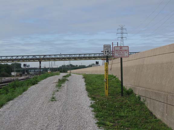
But these signs said otherwise.
So, I had to ride through East St. Louis. Fortunately, it was early in
the morning, and the area I had to ride through had
been destroyed by highway construction and general decay.
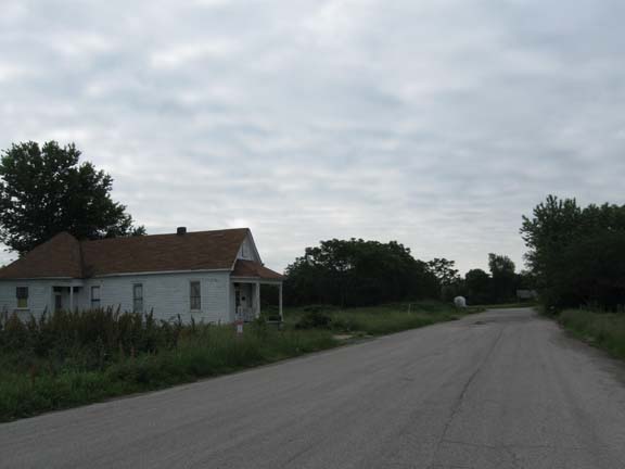
Bustling East St. Louis on a Friday morning.
It actually took me quite a while to work my way through ESL and get to
the city of Cahokia. Then I got myself turned
around and rode around a residential neighborhood for a while until I
unexpectedly came out right where I wanted to be. Eventually I got out
myself pointed in the right direction and reached the place where I
would have gotten off the forbidden trail.
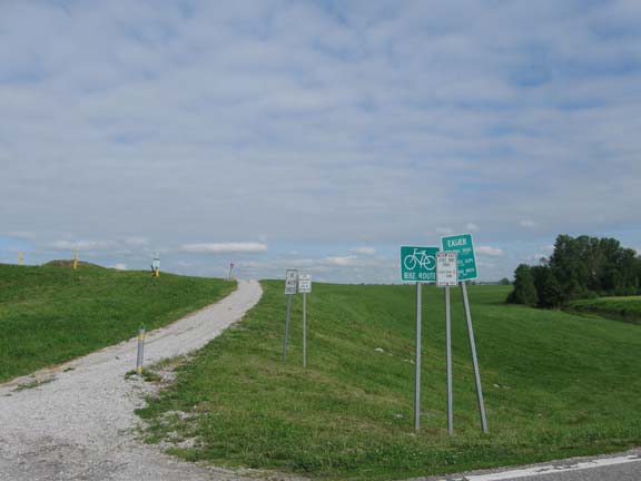
It was not forbidden after all. It really was a bike path.
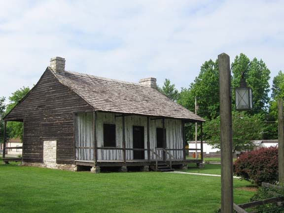
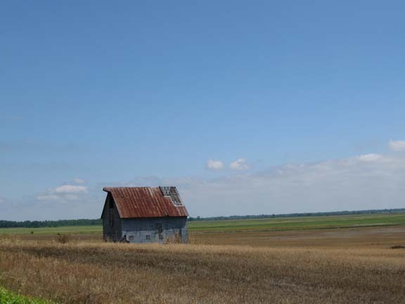
I try to stop at the various historic sites that I stumble across along
he way. Here's a token photo to represent all
of them. It's an example of Creole architecture--so said the sign.
So, I pulled out my first spare tube. Jam it in there. Pump it up.
Nothing. Pull it out. I tore it up pretty good somehow.
Last tube. Very careful. It works. Call Linda. She'll buy more tubes
and meet me later. The pump I have is awesome, but you have to be
really, really careful with it. So I've learned.
Finally, off into farm country.
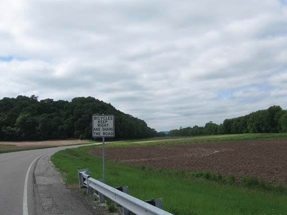
In Illinois they explicitly tell the cyclists to share the road--not
the drivers.
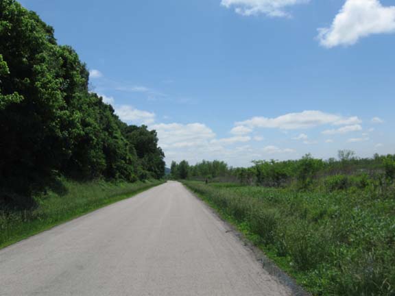
The rest of the day was much like last
year's last couple days. Cruising down the road along the edge of the
bluff. The wind moved around and became a stiff headwind--now that's
what I'm used to.
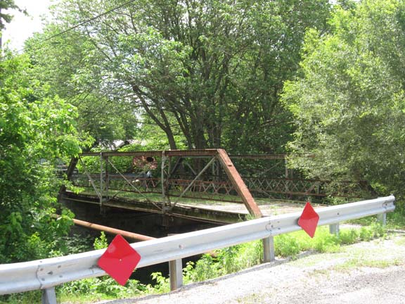
There's a bridge in a little town called Chalfins Bridge. The bridge is
closed. Infrastructure decay.
For several miles the road ran along a wildlife refuge. The water
reached nearly to the edge of the road.
I startled about a hundred huge frogs into jumping off the road into
the water.
Linda caught up with me on the way to the Fort DeChartres State
Historic Site. Turns out the flood waters have not receded everywhere
yet.
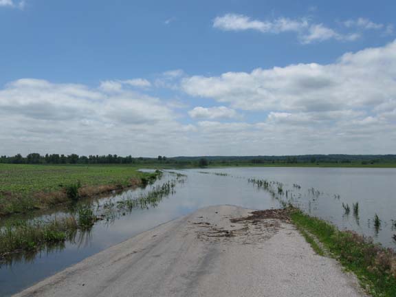
What do you do when you encounter standing water on the road?
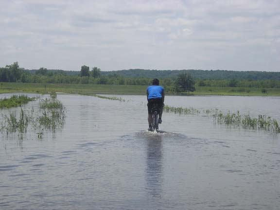
I'm not sure this is the right answer. But it was too inconvenient to
go around.
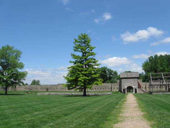
Fort DeChartres was apparently a very important place a very long time
ago.
Now it's a place that hard to take a good picture of.
From there I rode to the town of Prairie Du Rocher, where I bought a
sandwich at the general store and ate it sitting on the tailgate of the
Durango.
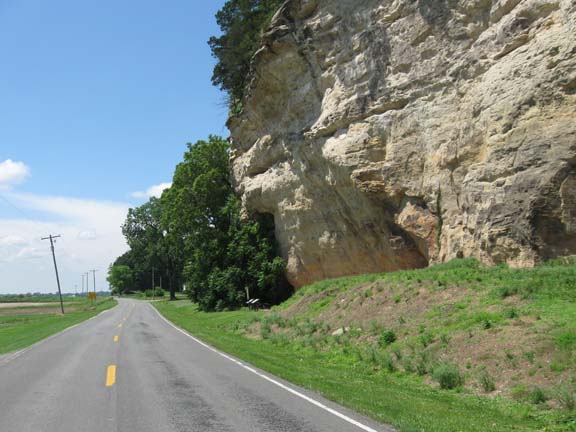
This is the Modoc Rocks. People have always used this overhang for
shelter. Judging by what I saw,
people still use these overhangs for storing hay and rusty farm
equipment.
At one point I was attacked by a big, nasty dog. I emptied my pepper
spray at him,
but it had no effect. I was able to outrun him. None of that has
anything to
do with this photo.
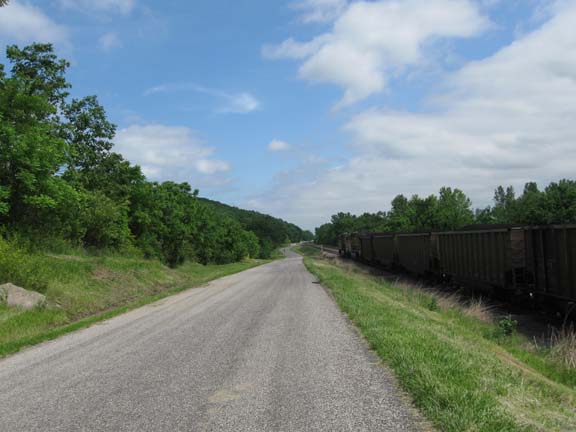
This train tried to pass me down the homestretch, but he couldn't make
it stick. The engineer waved and blew his horn
when he passed me, but he had to stop because there was another train
on the same rails facing the other
direction. I passed him back, and didn't
stick around to see how it would turn out.
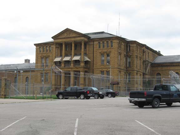
They don't build prisons like this anymore.
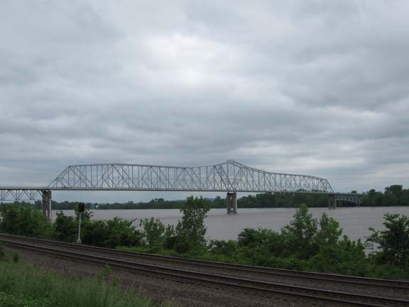
The Chester Bridge. Tomorrow morning I will cross this back into
Missouri.
It was a steep climb up into Chester and to the Best Western on the
other side of town. Chester, by the way, is the hometown of the guy who
created Popeye. There are statues of Popeye characters all over town,
and I think there's a Popeye Museum. I will be seeing very little of
that.
Next
"Tour of the South 2011" Copyright © 2011 By
Bob
Clemons. All rights reserved.