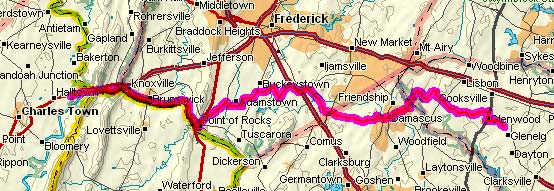
Dry Run 2: Day 2
9 May 2004
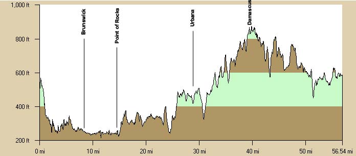
Harpers Ferry, WV to Glenelg, MD
59.8 miles, 4h59m, 12.0 mph
Elapsed Time: 7h05m, Max speed: 42.7mph
Total Climbing: 2972ft, Max elevation: 864ft

The campground was quiet at about 6:45am when I got up. Soon JT was
also stirring and we broke camp. We ate whatever we left over from
yesterday, for me that was a couple of low-carb energy bars and some
"fitness water." By about 8:30 we were on the road.
I remembered riding up the National Park's shuttle road in the past and
thought that we could ride down that way and avoid the traffic, so we
rode over to the visitor center and paid the $4 park entry fee. We rode
through the parking lot to where I thought the secret road was and
found the Park Service maintenance shed. Puzzled, we rode back to the
entrance booth and asked the ranger. She said we had to ride down the public road--we were only
allowed to ride the shuttle road if we were going uphill. So we just rode down US340
and turned off before crossing the Shenandoah River and back into
downtown Harpers Ferry.
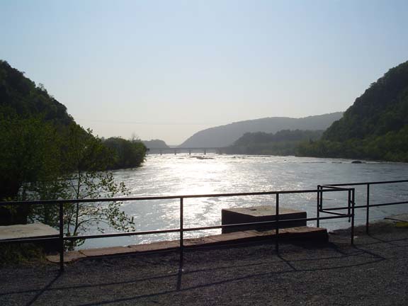
Looking down the Potomac from Harpers
Ferry
We hung around for a little while and then pedaled back across the
bridge and humped our bikes back down the stairs and onto the C&O
Canal towpath.
The path was mostly dry and there were few people about early on a
Sunday morning. We stayed on the towpath through Brunswick and on to
Point of Rocks--about 15 miles. I relived some of the intense boredom
I'd experienced on previous towpath rides. But it was better than
climbing over Catoctin Mountain.
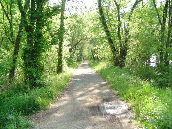
The C&O Canal Towpath
In Point of Rocks we stopped to have a snack and pick up some
sandwiches to eat later. We talked to the guy who runs the little
store. He said that business was very good, but he was worried about
the inevitable floods, which would certainly drown his business
someday. The last major floods were in 1996, when the area flooded
twice--once from a quick melt after a winter storm, and again after a
hurricane.
After our snacks, we climbed away from the river and onto the plains
south of Frederick. Then we had to face the Sugarloaf Mountin ridge.
Rather than climb on MD80, which would be a long hill with heavy
traffic, I figured we could climb on Flint Hill Road, which had almost
no traffic. The climb ended up being very long and very steep--reaching
16% at the steepest part. We wheezed for a while at the top and moved
on to Urbana, where we sat on the ground between a 7-11 and a cemetery
and ate our lunches.
The day was hot, with temperatures reaching the high 80s, and there was
very little breeze at first. Later the wind picked up and was usually
in our faces. We chose a different route from Urbana to Damascus in
order to avid the dirt roads, so instead we were constantly climbing
and descending small ridges. By the time we reached the Burger King, we
were hot and tired. After a couple of large iced teas, we began the
last leg.
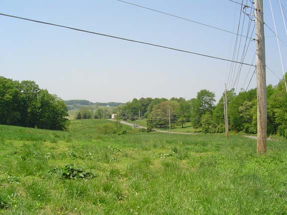
The rolling country of northern
Montgomery County
I had called my wife from Damascus and Linda was supposed to meet us in
Glenelg with the car. We were still several miles away (in the middle
of a climb) when she called to tell us that she was waiting. There was
plenty of time so she went out to a store and bought some water. She
called again when she got back to Glenelg (once again during a climb),
but we were still a few miles out. Finally, we rolled into the parking
lot and loaded up.
I think we learned a lot on this trip, but I can't remember what. There
was something to do with sleeping and something about getting
compression bag for my sleeping bag. It's all about putting bags in
bags in bags. Yup.
Previous
|
Next
"JT and BC's 2004 Pacific
Coast
Ride" Copyright © 2004 By Bob Clemons. All rights reserved.