Day 2
Saturday, 6 August 2005
Licking Creek Aqueduct Campsite, MD to Indian Flats Campsite, MD
82.8 miles, 6h59m, 11.9 mph
Elapsed Time: 12h00m, Max speed: 26.4mph
Total mileage: 158.4

I'd like to say that we were up at first light, but it was probably
more like third light. Paul Rito was quickly up and packed and on his
way to clear the spider webs off the trail for us. He did a good job.
The rest of us were ready to go by 7:30. The hikers still hadn't
stirred by the time we left.
While riding along Big Pool we got to see a guy drop his boat off his
trailer and onto the boat ramp when he was trying to pull the boat out
of the water. That had to hurt.
Shortly after that we reached Fort Frederick, an impressive 18th
Century stone fort that has never seen battle, mostly due to its
location in the middle of nowhere. I guess it seemed like a good idea
at the time. After a short and unneeded rest it was back on the trail
in search of breakfast.
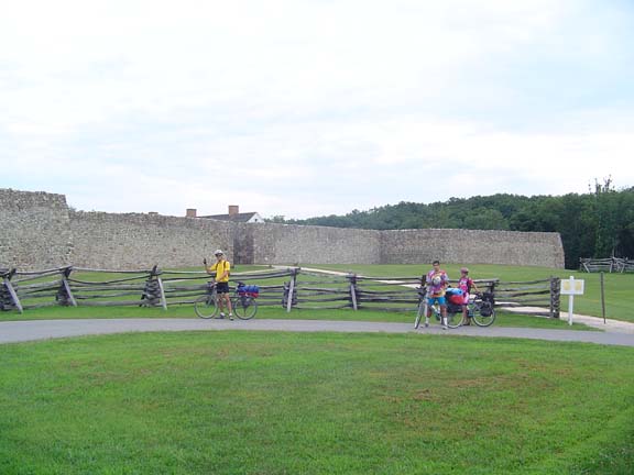
Fort Frederick in the morning.
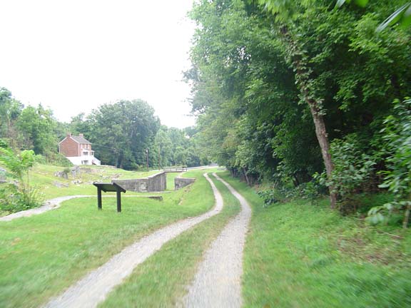
Some unremembered lock.
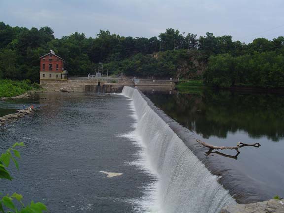
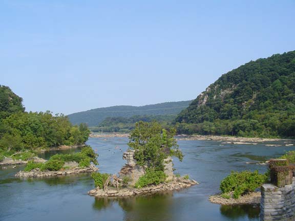
Scenic Dam 5--scene of this photo.
By the time we reached Williamsport we were pretty hungry. We climbed
the hill into town and found that the place we always eat (every five
years) was closed and for rent. The place across the street looked
promising, but it was going to take a while and the place was full of
smoke. So we rode a little farther and ordered breakfast sammiches at
the Sheetz. We took our stuff to a nearby park.
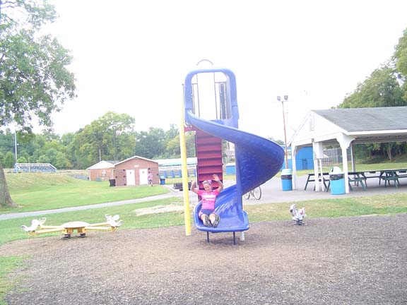
Fun in Williamsport.
I'm not sure that he was just as afraid as
all of us were....Curt.
Everyone stayed together for the initial steep climbs but then Melissa
attacked. Curt and I responded and soon it was just the three of us. We
took turns attacking each other but no one was dropped until about mile
four, when I fell back. I figured I could rejoin on the descent (I was
mistaken). With about a half mile to go Kevin bridged up to me, but
there was no hope of catching the other two and Curt and Melissa took
the stage.
After that we were pretty tired, but we got to wait a few minutes for
everyone else to catch up as we admired Dam 4.
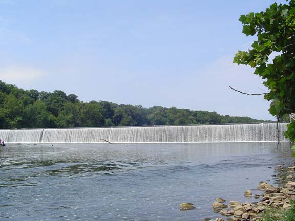
"Dam 4 is one bad mutha..."
"Watch your mouth!"
"I'm just talkin' 'bout Dam 4."
Soon after that we reached Scotty's bail out point at Shepherdstown. He
was originally planning to ride as far as Harper's Ferry, but after day
one he decided that Shepherdstown would be far enough. All he cared
about was getting farther than JT did in 1995. He beat him by over 50
miles. Woo-hoo!

Scotty, trying to escape by water...or taking a picture.
From there it was 12 miles to Harper's Ferry. We didn't want to leave
our bikes unattended on the trail so we hauled them up the stairs onto
the railroad bridge and then walked across into town. Then we leaned
the bikes against a hillside and left them unattended. Tony ran into
his family, who wisely declined to eat with us (remember no showers
last night--only pump baths).
We ate at the traditional place--the outdoor patio at the Coffee Mill.
The food was hot and the service was excellent--or was it the other way
around? We decided to hang out in HF for a while because it
wasn't far to our campsite and there wouldn't be anything to do there.
So we walked around for a while, had an ice cream, sat around, filled
our bottles with very warm water at the water fountain, took some
pictures...got tired of sitting around and left. Back across the
bridge, down the stairs, on to the trail.
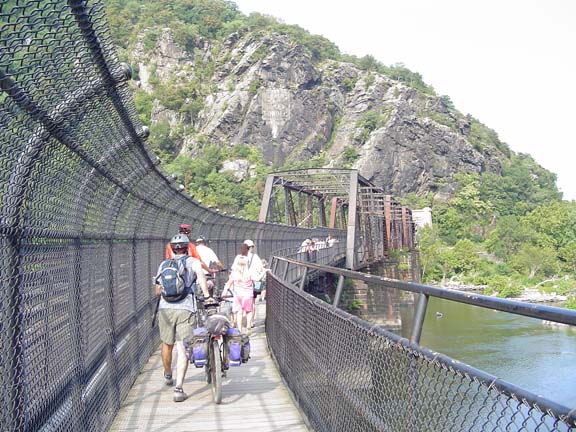
Back across the river.
A fine, fine day.
It was about five miles to Brunswick--"Home of the Iron Horse." On both
previous rides we had camped in the town park in Brunswick. The park
appears to have many permanent residents who don't mind listening to
the jarring sounds of trains mating all night long. There is a
switching yard in Brunswick and it's about 100 yards from the park.
This year we decided to try for the next hiker/biker site.
We did, however, want to visit Brunswick to pick up supplies. Kevin and
I rode into town and returned with Gatorade on our breath. The others
didn't believe our story about a strip club, so they rode into town and
bought some stuff for themselves, and some beer for everyone. Woo-hoo!
Our projected campsite was Bald Eagle Island. We were sorely
disappointed when we got there. The place was basically a mud flat, and
a family was living there already. Apparently they had come over
from West Virginia by boat to camp for free. It looked like they
were set up for the weekend. Not really the intented use of the
hiker/biker sites.
Anyway, we didn't like it and it was still early so we rode on. We
passed the town of Point of Rocks and reached the Calico Rocks
Campsite. It looked like a good campsite with lots of space and
grass--most of which was occupied by a tour group that was doing a
four-day fully-supported and sagged ride down the canal. That would
have been okay, but there was no water. The Park Service removes the
handle from the pump if the water isn't safe to drink.
We decided that we wanted water, so we mounted up and rode off again.
The next site was called Indian Flats. This one had less grass than
Calico Rocks, but more than Bald Eagle Island. It also had a
waterbourne West Virginia family and no handle on the pump. We couldn't
ride all night so we just set up camp and drank our beer. Without a
pump bath capability we had to settle for a partial muddy river bath.
It was a long and buggy night.
Previous
|
Next
"2005 C&O Canal Ride" Copyright © 2005 By Bob
Clemons. All rights reserved.